About This Station

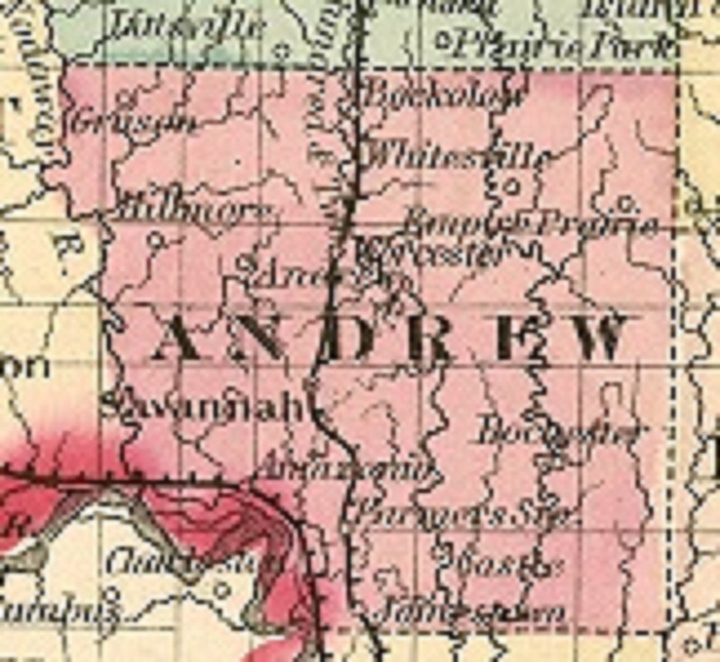
This station is located in Northwest Missouri in Andrew County. It is seven miles west of King City and five miles east of Rea (pronounced Ray) on Highway 48. It is placed along the side of a private driveway in an open area 100 feet away from any buildings or obstruction.
Our station is powered by a Davis Vantage Pro2 with a 24/7 aspirating fan blowing over its main sensor to optimize the most accurate air temperature and humidity readings. This station is fully solar powered. A Davis WeatherLink IP data logger grabs the information from the station to process and store it's readings. It also has an experimental weather server device called "meteobridge" and reports up to the minute weather conditions to this site. This station shares it's data with weather sites: AnythingWeather, Citizens Weather Observation Program- (look for station ID number EW2874 on NWS radar map), Midwestern Weather Network, North America Weather Network, and Weather Underground in the USA. It also sends it's data to AWEKAS in Austria, UK Met Office in the United Kingdom, and Wetter.com in Germany.
On January 1, 2015 Empire Prairie Weather installed a CyberPower CP1500AVRLCD UPS (uninterrupted power supply) to it's system. This device has the capability of allowing the station to continue reporting weather conditions for several hours in the event of a power failure. This feature will help keep viewers informed of severe weather conditions through their iPhones and mobile devices in case of a bad storm.
Empire Prairie Weather has incorporated Weather Simulator (WXSIM) software technology. This program gathers data from area METAR reporting stations and ingests data from this personal weather station. It then combines this data and generates a catered, personal forecast for its community. WXSIM forecasts are updated four times per day. Updates occur at 4:10 and 10:10 AM and PM.

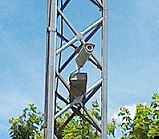
The Weather-cam is located 200 feet to the south-west of this station. It is mounted on a TV antenna tower at a height of 25 feet. The camera is facing a south-east direction looking towards the location where Empire Prairie existed. The Weather-cam is powered by a Ubiquiti AirCam 1.2. This camera is feed through the meteobridge device. The meteobridge captures an image every five minutes and sends it to this website. It produces a link that is sent to AnythingWeather, AWEKAS, and Weather Underground. A live image from this camera is feed through a SebTec IP time-lapse software. This time-lapse software captures an image every 45 seconds and produces a sunrise and the entire day video every day.
Data readings from this station and are featured on television station KNPN Fox 26 in Saint Joseph for their weather-casts. On April 26, 2018 The Tri-County News headquartered in King City began publishing a seven day forecast, generated from this ststion in their weekly paper.
CoCoRaHS

On October 21, 2014 Empire Prairie Weather joined the "Community Collaborative Rain, Hail and Snow Network" (CoCoRaHS) under station number MO-AW-7 and station name REA 5.5E. A Stratus RG202 Long Term Professional Rain and Snow Gauge was installed to make accurate precipitation reports based on their standards. Unlike the rest of this station, these measurements are taken and data is entered to their website manually.
With the combination from readings from the Davis station, we are able to give enhanced reporting to CoCoRaHS by reporting accurate time tables when rainfall occurs.
About This City

Empire Prairie is located one mile east from this station. It is mainly known today as a crossroads between Highway 48 and Routes M and P.
It was named Empire Prairie in 1856 by David Bonham Sr. who came from Wisconsin and homesteaded in the area. Other early contributors to this community were Brown and Sherman, (the community park is named after Billy Sherman). The Brown family donated the land where a church once stood.
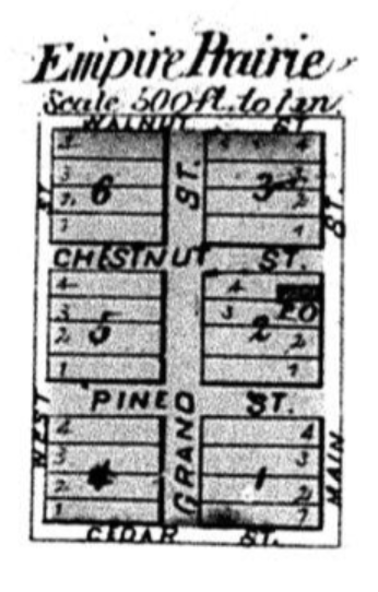
The town wasn't much even in it's heyday. In a way, it was a town that never was. Originally, Empire Prairie was to be established one half mile south of the Highway 48 intersection around where the cemetery is located on Route M. A map of the proposed town (located on the right) was drawn up in hopes of being awarded a rail-road spur. It had a post office in 1870 and served approximately 150 residents. (The post office was located in the downstairs of the home formally occupied by Lester and Thelsa Wall). A church once stood to the east of this home where the cemetery is located. Unfortunately, the rail-road spur was awarded to King City located six miles east of this location and Empire Prairie never developed.
All that remains today is a vacant lot at the crossroads where a general store once sttod. It was built in the early 1930's after Highway 48 was constructed. It was razed in early 2022. A community building where the school once stood before being destroyed by a tornado. There is church statue where a Presbyterian church (not the one by the cemetery) once stood before being consumed by fire, and the cemetery. All these remains are spread over a mile radius.
Some stories claim Empire Prairie was located 2 miles north from the Highway 48 intersection on route P at the crossroads of 103 and 113. However, this area was simply known as Empire (the map on the left shows Empire Prairie where I described). Empire did contained a general store with an ice house on the north-east corner. I recall the vacant store along with a row of adjoining buildings stretching eastward on county road #113 in my younger days. I was told there were the remains of a barber shop in one of the vacant facilities. The Star Chapel Methodist Church still remains in operation on the north-west of the intersection. There was also a blacksmith shop operated be George Christie on the south-east side. Although this area wasn't really a Mason-Dixon line, Empire was established separately from Empire Prairie because it favoured the Union while Empire Prairie was more Confederate. In fact, past generations referred the Empire Methodist as the "North" church and the Empire Prairie Presbyterian as the "South" church.
Despite all these mishaps, its name has endured. Nearly everyone in Northwest Missouri is familiar with Empire Prairie and knows its location. In 2013 local independent film-maker Blake Eckard from Stanberry used this locale for a namesake in a feature film he produced and directed "Ghosts of Empire Prairie".
About This Website
This site is a template design by CarterLake.org with PHP conversion by Saratoga-Weather.org.
Special thanks go to Kevin Reed at TNET Weather for his work on the original Carterlake templates, and his design for the common website PHP management.
Special thanks to Mike Challis of Long Beach WA for his wind-rose generator, Theme Switcher and CSS styling help with these templates.
Special thanks go to Ken True of Saratoga-Weather.org for the AJAX conditions display, dashboard and integration of the TNET Weather common PHP site design for this site.
This website was edited for local content by this personal weather station's owner and manager Steve Lancey.
Template is originally based on Designs by Haran.
This template is XHTML 1.0 compliant. Validate the XHTML and CSS of this page.


